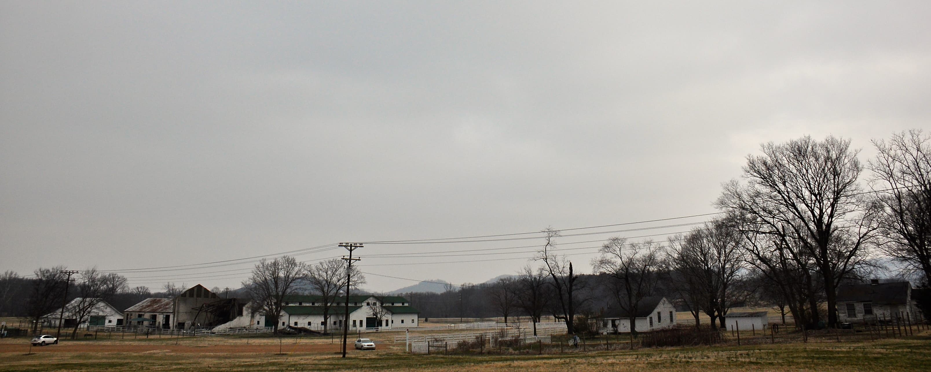
The Tennessee Walking Horse National Celebration has run every year since September 1939, drawing roughly 250,000 visitors to a 100-acre equestrian complex at 1110 Evans Street in Shelbyville. That event shaped Bedford County's land market more than any highway project or zoning ordinance. Horse farms, working pastures, and hay fields dominate the landscape, which means buyers often find land that has been actively managed rather than left to grow over.
Bedford County is also changing. Interstate 24 puts Murfreesboro within 35 minutes and Nashville within about an hour, and the county's population grew close to 10% between 2010 and 2020. Land prices reflect that tension between agricultural heritage and suburban pressure from the north.
What the Land Actually Looks Like
Bedford County spans 475 square miles at the boundary between the Central Basin and the Eastern Highland Rim, two geologically distinct zones with different soil profiles and different land-use histories.
The Central Basin portion, concentrated in the northern and western parts of the county near the Duck River, sits on Maury series soils: deep, well-drained limestone loam that formed over phosphatic limestone bedrock. These soils are among the most productive agricultural soils in Tennessee, historically prized for horse breeding because the natural phosphate content supports strong bone development. Permeability is good, drainage is good, and septic system feasibility is generally high for conventional drainfields.
The eastern and southern edges of the county grade into Highland Rim terrain, where soils are thinner, more acidic, and more chert-heavy. Parcels here often run cheaper per acre but require more scrutiny before you plan a homesite.
One feature that cuts across both zones is karst geology. Bedford County has sinkholes, sinking streams, and subsurface solution channels throughout its limestone bedrock. That creates two specific concerns for buyers: karst features can eliminate otherwise-good soil for a conventional septic system, and karst aquifers are vulnerable to surface contamination in ways that deeper confined aquifers are not. On any limestone parcel, ask a licensed soil scientist to check for solution channels near your proposed drainfield before you make an offer.
If you're not sure what a soil evaluation involves or what the county evaluator will look for, understanding perc tests in Tennessee covers the process in detail.
Zoning and the Subdivision Rule
Bedford County adopted its countywide Zoning Resolution on November 10, 2020. Most of unincorporated Bedford County falls under Agricultural or Rural Residential zoning. Both designations permit conventional agricultural uses by right, including horse training and breeding, though commercial equestrian event venues require additional review.
The four incorporated municipalities (Shelbyville, Wartrace, Bell Buckle, and Normandy) maintain their own independent zoning authority, separate from county regulations entirely.
One rule that catches buyers off guard: under T.C.A. § 13-3-401, any division of a parcel into lots of less than 5 acres for sale or building development requires Bedford County Planning Commission review and plat approval. If you're buying land with any intent to subdivide smaller tracts, confirm the current requirements before you close.
Flood Zones Along the Duck River
The Duck River runs roughly east to west through the center of Bedford County, fed by Garrison Fork, Noah Fork, Wartrace Fork, and Butler Creek. It's one of the most biologically diverse freshwater rivers in North America and a primary drinking water source for about 250,000 people in Middle Tennessee. It also floods. Parcels near the Duck River's main channel or its tributary creeks fall within FEMA Zone AE, the 100-year floodplain designation with established Base Flood Elevations.
Normandy Reservoir sits at the Coffee/Bedford County line on the Duck River. Parcels adjacent to the reservoir or in the downstream reach carry their own flood zone designations reflecting the dam-controlled hydrology.
The bottomland along these waterways is often the most attractive land in the county: rich soils, established pastures, scenic water access. It's also where flood risk concentrates. Many buyers don't realize that a 60-acre horse farm can have a perfectly buildable homesite while 15 of those acres are in Zone AE along a creek bend.
LandWise intersects a parcel's boundary with NFHL data and reports the percentage of the parcel in each FEMA zone, the SFHA designation, base flood elevation where available, and the FEMA panel ID. If a farm has a quarter of its acreage in Zone AE, that shapes what you can build and where, and it affects flood insurance requirements for any lender. Knowing that before you negotiate is worth more than finding it out at the title table.
You can also pull the official FEMA Flood Map Service Center maps at msc.fema.gov for any parcel with a street address.
Property Taxes and Greenbelt Enrollment
Bedford County's current property tax rate is $2.3252 per $100 of assessed value (fiscal year 2025-26). Tennessee assesses farm and residential property at 25% of appraised value, so a parcel appraised at $400,000 carries an assessed value of $100,000 and an annual tax bill around $2,325, before any greenbelt adjustment.
Most working farms in Bedford County qualify for greenbelt enrollment under T.C.A. §§ 67-5-1001 through 67-5-1050, the Agricultural, Forest and Open Space Land Act of 1976. Qualifying agricultural land (minimum 15 acres) is taxed at use value rather than market value, which can reduce the effective tax substantially on a working horse or cattle farm.
The thing buyers need to understand: if greenbelt-enrolled land gets converted to a non-qualifying use, rollback taxes become due. For agricultural or forest land, that's three years of back taxes calculated at the full market-value rate rather than the use-value rate. If the parcel was enrolled before you bought it, you inherit the rollback liability risk. Ask the seller for the current enrollment status and what the rollback amount would be before you sign anything.
Water and Utilities
Rural Bedford County runs almost entirely on private wells and private septic systems. Municipal water service doesn't extend to most unincorporated properties. Wells tap into limestone karst aquifers at typical depths of 80-300 feet, though depth varies considerably with local geology. TDEC requires steel casing with a minimum 6 5/8-inch diameter and at least 50 feet of separation between the well and any septic drainfield.
Because karst aquifers can carry contaminants from surface runoff and sinkhole drainage, a full water quality panel (not just a bacterial screen) is worth the cost on any existing well.
Electric service is available throughout most of the county via Middle Tennessee Electric. Broadband is uneven: properties near Shelbyville have cable or fixed wireless options, but remote rural areas often rely on satellite service.
What Land Actually Costs
Bedford County land prices reflect two buyer pools competing for different things.
Horse farm buyers and agricultural operators want Central Basin pastureland with improved fields, perimeter fencing, and access to hay production. Those parcels command premiums above raw land values, particularly if there are barns or run-in sheds already in place.
Raw land buyers working toward a homesite or recreational use will find more accessible price points. Recent data puts raw land prices roughly in these ranges:
- $9,000-$12,000 per acre for larger tracts (20-100 acres)
- $12,000-$17,000 per acre for mid-size tracts (10-20 acres)
- $17,000-$24,000 per acre for smaller tracts (5-10 acres)
Bedford County has appreciated above the state average over the past several years, driven by I-24 corridor commuters from Murfreesboro and Nashville. That pressure is real and ongoing.
Three Things Bedford County Buyers Often Get Wrong
Karst isn't visible from the road. A parcel with beautiful pasture can still have subsurface solution channels that rule out conventional septic placement. A professional soil evaluation before making an offer costs far less than learning this after closing.
Greenbelt enrollment status matters. Greenbelt can cut the effective tax significantly, but it also creates rollback liability if the land use changes. Verify enrollment status and calculate potential rollback before negotiating a price that assumed greenbelt savings.
Not every road is a public right-of-way. Bedford County Highway Department maintains publicly dedicated roads only. If the only access to a parcel runs across a private drive or over a neighbor's land via an easement, confirm the easement is recorded, that it runs with the land, and what maintenance obligations apply to you.
Bedford County rewards buyers who verify before they sign. The agricultural land is productive, the equestrian community is genuine, and the location relative to Murfreesboro and Nashville is better than it looks on a map. Understand the soil and flood situation before you negotiate, know what greenbelt enrollment means for your plans, and confirm your access. That's the due diligence that separates a good purchase from an expensive lesson.