Rural land in Campbell County sells in the $10,000 to $17,000 per acre range, but that figure covers a spread of three or four times. A timbered ridge parcel and a Norris Lake waterfront lot aren't just priced differently. They're governed differently, and the extra layer on waterfront land belongs to the Tennessee Valley Authority, not the county.
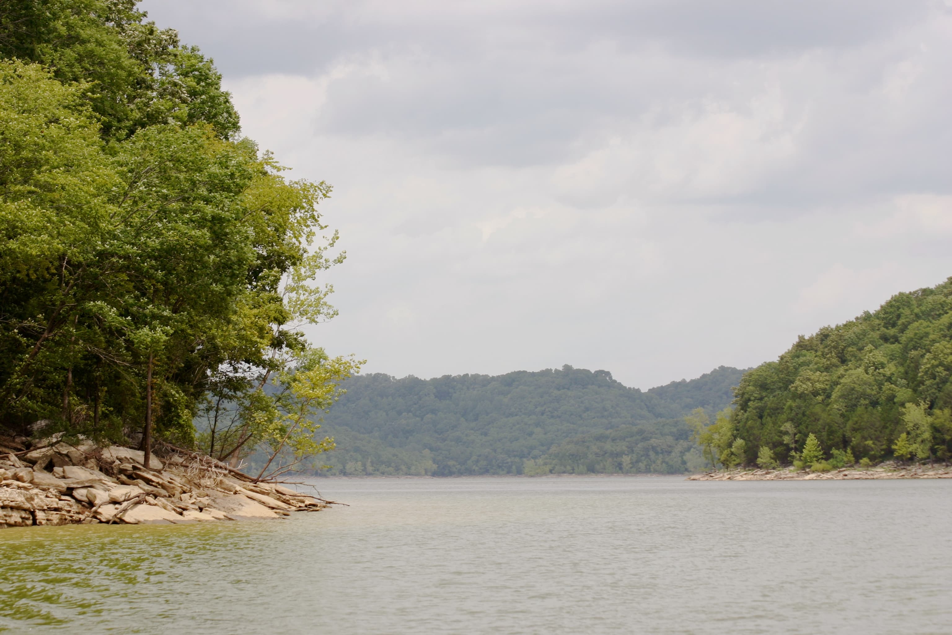
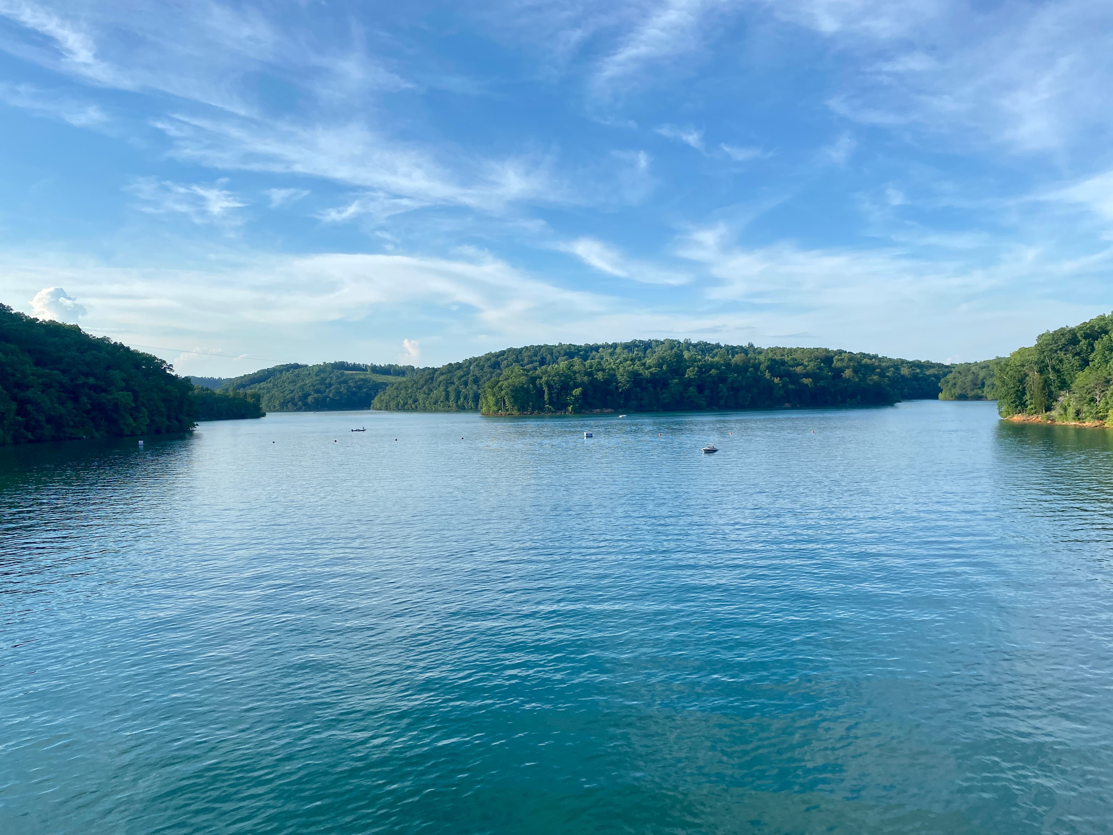
Campbell County sits in Northeast Tennessee, roughly 35 miles north of Knoxville. The terrain is serious: the county straddles the Cumberland Mountains and the Powell River valley, with elevation changes of more than 2,000 feet between creek bottoms and ridgelines. Norris Lake, the first reservoir TVA ever built (completed in 1936), forms most of the county's western and southern boundary with Anderson and Union counties.
Zoning: The County Doesn't Have It
Campbell County has no county-wide zoning ordinance. Land outside municipal limits is unzoned, which means no setback requirements, no use restrictions, and no density limits enforced by the county. The incorporated towns of LaFollette, Jacksboro, Jellico, and Caryville maintain their own zoning, but land beyond those boundaries is open for most uses without a county zoning permit.
That freedom cuts both ways. You can build a cabin, run a small farm, or park equipment without a county approval. Your neighbor can do the same. If you're buying near a town boundary, verify the line carefully. Some towns have annexed parcels along highway corridors, and the edge isn't always obvious from a listing map.
The county does enforce subdivision regulations. If a seller carved your parcel from a larger tract after 1983, it should have passed through the county planning commission. The Planning Commission office is at 570 Main Street in Jacksboro (423-562-2526), and they can confirm whether a subdivision was properly recorded.
Norris Lake: What TVA Controls
Here's a sentence that catches first-time waterfront buyers off guard: TVA owns or holds easements on most of the Norris Reservoir shoreline. Of the reservoir's 809 miles of total shoreline, 42 percent is owned outright by TVA, and another 16 percent is "flowage easement" land where TVA holds the right to flood the property and limit construction. Only a fraction of the shoreline is fully private.
Your lakefront deed may not extend to the water's edge. Any construction or alteration at or near the water, adding a dock, placing riprap, modifying a boat slip, requires a Section 26a permit from TVA. This applies even to minor changes on existing structures. New owners must notify TVA within 60 days of acquiring any property with a TVA easement.
Size limits for residential docks on new developments are 1,000 square feet. Properties in areas of preexisting development may be eligible for up to 1,800 square feet. Covered docks cannot exceed one story, though an open upper deck with railing is permitted. TVA targets a 100-day turnaround on minor permit applications, but the process typically includes a site visit.
If you're looking at a Norris Lake parcel, ask the seller whether an existing TVA permit covers any dock or structure, and get TVA's easement boundary confirmed before closing. This detail often isn't in the listing, and it materially affects what you can build.
Mineral Rights: A County-Specific Caution
Campbell County has one of the more complicated coal histories in Tennessee. During the 1870s and 1880s, northern and British investors bought up large coal acreages across the Appalachian coalfields. By the early 20th century, a British concern called the American Association controlled roughly 80 percent of the land in Campbell and neighboring Claiborne counties. Those acquisitions typically severed the mineral estate from the surface estate, and that separation persists in the deed chains today.
For buyers: if a listing doesn't specify whether mineral rights convey, assume they may not. A title search will show whether minerals were conveyed separately and who currently holds them. In Tennessee, a mineral rights owner has legal authority to access the surface for extraction, with limited notice and compensation requirements for the surface owner.
This isn't a reason to pass on the county. Many severed mineral interests haven't been exercised in decades, and active coal or gas operations are clearly disclosed in most transactions. But you need to know what you're buying before you close. See our guide to mineral rights in Tennessee for a fuller account of how severance works statewide.
Road Access and Terrain
The ridgelines and hollows of Campbell County are scenic, but parcels above the main road network can be difficult to access year-round. Private roads, gated easements, and seasonal tracks are common. A small number of parcels in the deeper coves have no legal road frontage at all. Tennessee's Private Way Act (TCA 54-14-101 through 54-14-115) gives a landlocked owner a petition process for establishing a private road across neighboring land, but it requires a court proceeding and takes time.
Before making an offer on any rural parcel in the county, confirm:
- Whether the parcel touches a publicly maintained road or only a private track
- The legal basis for access if a private road is involved (a recorded easement, not just a longtime custom)
- Whether any seasonal creek crossings become impassable after heavy rain
Slope is the other variable that determines what you can actually do with a parcel. Much of the county sits above 15 percent grade, which complicates driveway permitting and septic system placement. The Tennessee Department of Environment and Conservation requires a site evaluation before issuing a septic permit. On steep terrain, that evaluation often leads to an engineered system requirement with costs that can reach $20,000 or more.
LandWise reports whether a parcel touches a road at all, the distance to the nearest road, and a slope distribution showing what share of the acreage falls above 15 percent and above 30 percent. For Campbell County parcels specifically, those numbers help you filter out properties where the access or septic situation will add major cost before you spend money on a survey. See also: landlocked land in Tennessee.
Taxes and the Greenbelt Option
Property taxes in Campbell County are low. The certified county tax rate was set at $1.2156 per $100 of assessed value following a 2024 reappraisal. Vacant rural land in Tennessee is assessed at 25 percent of appraised value. On a $100,000 parcel, the annual county tax bill works out to roughly $304 at that rate.
If you plan to use the land for timber or farming, the Tennessee Greenbelt Law (TCA 67-5-1001 et seq.) lets you apply for an agricultural or forestry assessment based on production value rather than market value. The savings on a larger tract can be significant, but the program has minimum acreage requirements, requires qualifying use, and triggers rollback taxes going back up to three years if you sell or change use.
The land market in Campbell County has seen double-digit appreciation in recent years, driven in part by buyers from Knoxville and beyond looking for recreational and investment property. Norris Lake frontage is constrained by TVA's land holdings, which keeps supply tight. Ridge and timber parcels remain more available at lower per-acre prices, but they require more careful due diligence on access and soils.
The mineral rights situation, the TVA restrictions near any water, and the road access question are the three issues most likely to surprise buyers in this county. Address all three before you make an offer.