Two things catch most buyers off guard in DeKalb County. First: Center Hill Lake, the 18,220-acre reservoir that anchors the county's eastern edge, is managed by the U.S. Army Corps of Engineers, not TVA. That single distinction changes how shoreline permits work. Second: the county has no zoning code for unincorporated land, which opens up flexibility but removes the guardrails buyers in surrounding counties take for granted.
DeKalb County sits in the Upper Cumberland region of Middle Tennessee, roughly 60 miles east of Nashville. Smithville, the county seat, has about 4,400 residents. The terrain is eastern Highland Rim: rolling limestone karst with sinkholes, cedar glades, and the Caney Fork River cutting through the middle before widening into Center Hill Lake.
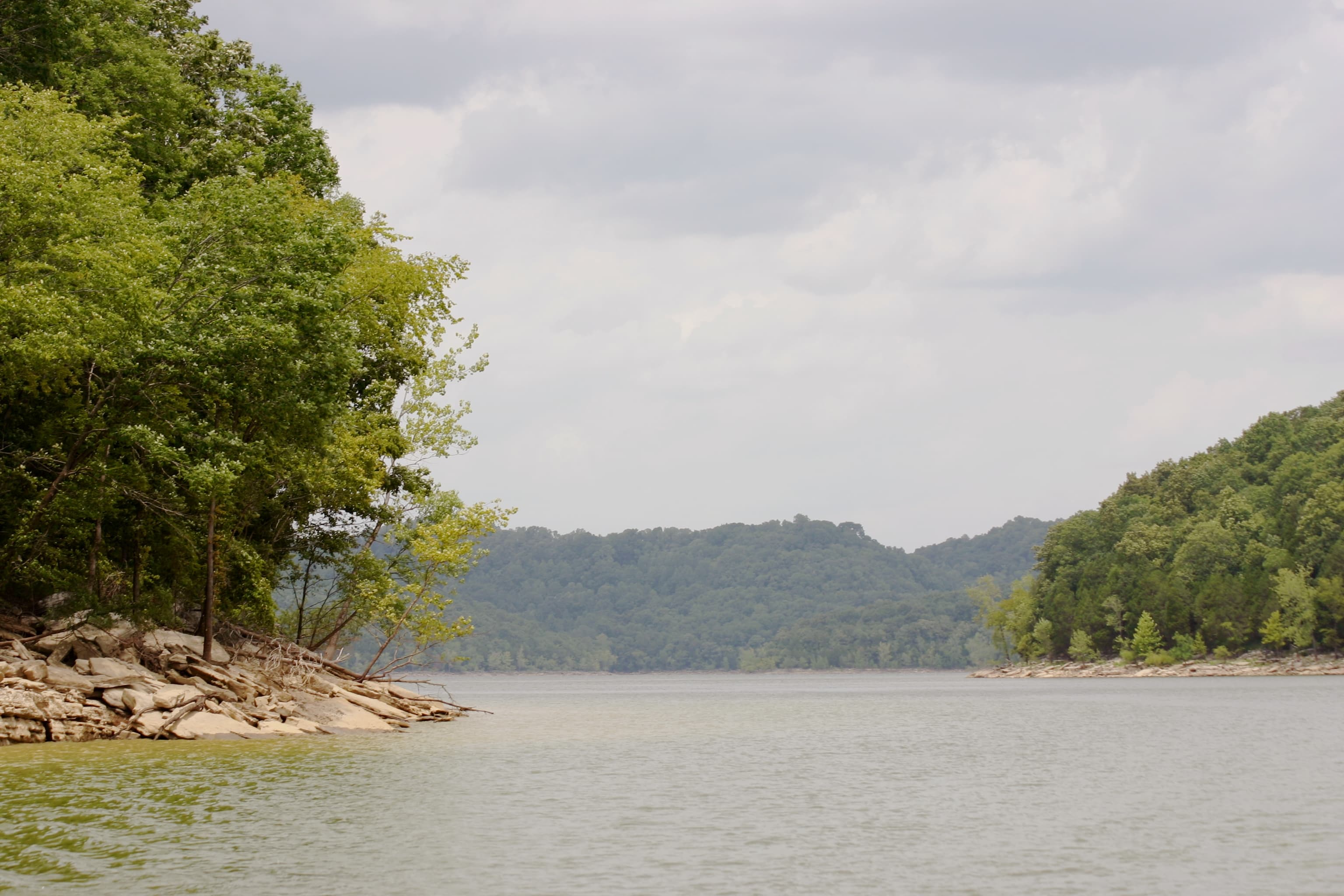
Center Hill Lake and Army Corps Permits
Center Hill Lake is the dominant reason buyers come to DeKalb County. The lake is 64 miles long with 415 miles of shoreline, most of it undeveloped. The Army Corps completed the dam in 1949 for flood control on the Caney Fork River; power generation and recreation followed.
Because the Corps, not TVA, manages the lake, TVA's Section 26a shoreline permit rules don't apply here. Buyers who've dealt with TVA lakes elsewhere sometimes assume the same framework. It isn't. For any work on Corps-managed shoreline property, you need a Shoreline Use Permit from the Nashville District. Seawalls, bulkheads, and vertically stacked stone retaining walls are specifically not authorized under Regional General Permit 20-01. Dock structures must fit within a 1,000- or 1,800-square-foot footprint and can't extend more than 150 feet from the shoreline or more than one-third of the way to the opposite bank, whichever is shorter.
For properties that sit on flowage easement land rather than full fee ownership, there's an additional constraint: the Corps requires at least 50 feet of horizontal separation between any subsurface septic field and the normal summer pool elevation. That's a real site-planning constraint on narrow parcels.
Flood zones around the reservoir reflect active water management. Properties in the near-shoreline zone carry AE and X designations depending on elevation relative to base flood elevation. Run the parcel through FEMA's Flood Map Service Center (msc.fema.gov) before making any assumptions about buildability.
Zoning: What "Unzoned" Actually Means Here
DeKalb County does not have a county-wide zoning ordinance for unincorporated areas. This is common in smaller Tennessee counties but worth understanding clearly: there is no minimum lot size for rural land, no use restrictions separating residential from agricultural or commercial, and no setback requirements from the county. You could place a barn 10 feet from the property line in an unincorporated area without a county variance.
What does exist: land subdivision regulations that govern how parcels are divided for sale or development. If you're buying a tract that was recently split from a larger parcel, confirm the split complied with county subdivision rules before closing. The DeKalb County Planning office (Tommy Lee, 931-979-2170) can answer questions about specific parcels.
State building codes adopted in 2011 do apply to new construction in unincorporated areas. So you'll still need a building permit for a residence; you just won't need a zoning variance to use the land.
The practical implication: due diligence in DeKalb County leans harder on deed restrictions, easements, and adjacency than it does elsewhere. What your neighbor decides to put on their land is substantially their business.
Karst Geology and the Septic Question
The limestone karst underlying most of DeKalb County creates a specific problem for septic systems. Karst terrain is characterized by sinkholes, solution cavities, and underground drainage channels. When septic effluent enters a sinkhole or fractured bedrock, it can move rapidly through the subsurface rather than filtering through soil. That's a problem both for system performance and for well water quality.
Tennessee's rules for septic approval (TDEC Division of Water Resources, Rules 1200-01-06) require a percolation test when soil perc rates reach 75 minutes per inch or slower. On karst, the problem often isn't a slow perc rate; it's a fast one caused by fractured rock rather than soil filtering. A county environmental health inspector can flag this during a site evaluation, but identifying karst risk before you spend money on a perc test is worth doing.
LandWise pulls SSURGO soil data for any DeKalb County parcel and returns drainage class, hydrologic group, depth to restrictive layer, and water-table depth, then assigns a perc-risk rating (high, moderate, or low) and a septic feasibility verdict (suitable, marginal, or unsuitable). On a karst parcel with shallow bedrock, the depth-to-restrictive-layer value will catch that before you've hired an engineer. It doesn't replace a county perc test, but it tells you which parcels are worth ordering one for.
Buyers planning to drill a well should know that the same karst drainage makes groundwater contamination pathways shorter than on fractured-free rock. Check for nearby agricultural land use and any known sinkholes on or adjacent to the parcel. The well water considerations that apply broadly across Tennessee become more pointed in karst terrain.
Property Taxes and the Greenbelt Option
DeKalb County's property tax rate is currently $1.533 per $100 of assessed value, down significantly from the prior rate of $2.51. Under Tennessee's statewide assessment rules (TCA 67-5-801), residential and agricultural land is assessed at 25% of appraised value. So a 50-acre parcel appraised at $200,000 carries a taxable assessed value of $50,000, and the annual tax bill would be about $766 at current rates.
Forest and agricultural land qualifies for Greenbelt treatment under Tennessee's Agricultural, Forest and Open Space Land Act of 1976. To qualify, forest land must be at least 15 acres under a sound sustained-yield management program with a plan prepared by a Consulting Forester. The assessor values the land at its current use rather than highest and best use, which typically cuts the tax bill substantially. The application deadline is March 15 to be considered for the current tax year. If you later convert Greenbelt-enrolled land to another use, Tennessee collects rollback taxes covering the prior three years (agricultural and forest) or five years (open space).
Contact the DeKalb County Tax Assessor at 732 S. Congress Blvd, Room 104, Smithville to confirm current Greenbelt enrollment status on any parcel before closing. Sellers sometimes let enrollment lapse without disclosing it; finding out after closing means inheriting the rollback liability.
For a deeper look at how Tennessee's property tax structure works across categories, see Understanding Tennessee Property Taxes for Vacant Land.
Utilities and Broadband
The power grid in DeKalb County is served by Middle Tennessee Electric and, in some areas near the lake, by smaller coops. For rural parcels away from roads, confirm whether power infrastructure actually reaches the parcel line or whether extension costs apply. The county's road network is reasonably dense near the lake but thins out in the more remote western portions.
Broadband coverage in DeKalb County is stronger than you'd expect for a rural county of 20,000 people: 99.87% coverage with 11 providers active in the county. Fixed wireless covers about 93% of the county. That said, the number of providers available at any specific address varies. The FCC's broadband map lets you search by address to see which providers are actually present at a given location.
Septic and water systems apply to essentially all rural parcels outside Smithville. See the septic discussion above on karst risk. For perc test requirements specific to Tennessee, the process and timeline are consistent across the state.
What to Check Before You Offer
For any DeKalb County parcel, the non-negotiable items before an offer:
- Whether the parcel abuts Corps-managed shoreline and what easement type (fee simple vs. flowage) applies
- Flood zone designation from the FEMA MSC
- Depth to bedrock from SSURGO data (karst risk indicator)
- Whether the parcel has road frontage or requires an access easement
- Current Greenbelt enrollment status with the tax assessor
- Power line proximity if the parcel is rural
The lack of county zoning removes some friction but also removes useful information about what adjacent parcels can become. For any parcel where the neighbors' use matters to you, check deed restrictions and talk to the planning office about anything under review nearby.